DonaldHealdRareBooks has issued a catalogue of PocketMaps. These are 19th century American maps, generally used by travelers, shippers, and settlers as they made their way around the country in times when travel was slower and more complicated. Many show the routes of their day, generally rivers and canals in the early part of the 19th century, railroads and stage lines a few decades later. These maps usually folded out from hard covers that protected them. Today's automobile road maps are essentially disposable, readily available, inexpensively replaced. These were meant to last through long journeys and needed protection. While meant to show people the way at the time, today these maps provide a graphic history of the expansion and development of America. Now, geographical boundaries are mostly constant. In the 19th century, they were constantly changing. These are a few of Heald's old pocket maps.
Item 3 is the 1833 (second edition) of Mitchell'sTravellersGuideThroughtheUnitedStates.AMapoftheRoads,Distances,SteamBoat&CanalRoutes.Of course, the United States was not so large then, but it covers everything from the east coast to the Missouri Territory, and shows the edge of Texas (then part of Mexico). Otherwise, except for the northern part of Maine and the southern tip of Florida, it is all there. The index includes information about steamboat and canal routes along with various statistics. Priced at $1,000.
By 1849, the means of transportation was rapidly changing. That is when this 70-page guide with a large fold out map of the United States was published: Phelps'sTravelers'GuidethroughtheUnitedStates;ContainingUpwardofSevenHundredandFiftyRailroad,Canal,StageandSteamBoatRoutes. The map covers the same states, with northern Maine and southern Florida clipped off (they are shown on insets), but another inset now shows the states and territories to the west, all the way to the Pacific. This came just after the conclusion of the Mexican War, so California and a Texas much larger than today are included (Texas borders on California), though the Mexican border was farther north than it is today (this is pre-Gadsden Purchase). The map is bordered by images of American presidents and other important figures. As the title indicates, the transportation routes now include railroads, rapidly expanding at this time. Item 4. $1,250.
Item 21 is Anthony Findley's pocket map of Tennessee. It dates to around 1830. It shows towns, roads and rivers, with counties identified, except for the southeast corner, which is labeled “Cherokee Indians.” Those who grew up as fans of Davy Crockett will appreciate this map, as this is the Tennessee he represented in Congress, shortly before moving on to Texas. $750.
Item 24 is J.M. Atwood's MapoftheWesternStates. The western states were not what they are today in 1853. They range from Ohio to Iowa, what we would consider the midwest now. The map provides detailed county breakdowns, and is preceded by a guide which includes railroad, canal, state and steamboat routes. $800.
Dominic Winter Auctioneers September 11 Printed Books, Maps & Manuscripts, The Polydore Vergil bound for Queen Mary I
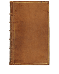
Dominic Winter, Sep. 11: Exquemelin (Alexandre Olivier). The History of the Bucaniers of America..., 4 parts in one, 3rd edition, 1704. £1,000-1,500
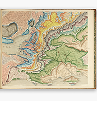
Dominic Winter, Sep. 11: Greenough (George Bellos). A Physical and Geological Map of England & Wales..., Geological Society, July 1865. £5,000-8,000
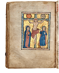
Dominic Winter, Sep. 11: Illuminated Psalter. Manuscript Psalter with Calendar, Flanders or North-East France, late 13th century. £7,000-10,000
Dominic Winter Auctioneers September 11 Printed Books, Maps & Manuscripts, The Polydore Vergil bound for Queen Mary I
Dominic Winter, Sep. 11: Book of Hours. Illuminated manuscript on vellum, Use of Rome, in Latin, Florence, c. 1470s. £3,000-5,000
Dominic Winter, Sep. 11: Henry VIII (King of England). Assertio septem sacramentorum adversus Martinum Lutherum, Antwerp: Michiel Hillen, 1522. £3,000-5,000
Dominic Winter, Sep. 11: Binding for Queen Mary I of England and Ireland. Polydori Vergilii Urbinatis Anglicae..., 1555. £20,000-30,000
Dominic Winter Auctioneers September 11 Printed Books, Maps & Manuscripts, The Polydore Vergil bound for Queen Mary I
Dominic Winter, Sep. 11: Llwyd (Humphrey). The Breviary of Britayne..., 1st edition in English, 1573. William Lambarde's copy. £2,000-3,000
Dominic Winter, Sep. 11: Embroidered Binding. The Whole Book of Psalmes..., Imprinted for the Company of Stationers, 1634. £700-1,000
Dominic Winter, Sep. 11: Astronomy Manuscript. [Shakerley, Jeremy (1626-c.1655). Tabulae Britannicae, the British tables…], late 17th c. £1,000-1,500
Dominic Winter Auctioneers September 11 Printed Books, Maps & Manuscripts, The Polydore Vergil bound for Queen Mary I
Dominic Winter, Sep. 11: Vellucent Art Nouveau Binding [Book of Common Prayer] by Herbert Granville Fell, 1900. £1,000-1,500
Dominic Winter, Sep. 11: Palladio (Andrea). The Architecture of A. Palladio; in Four Books, 2nd edition, 1721. £2,000-3,000
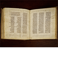
Sotheby’s 10 September 2024 The Shem Tov Bible
Koller Auctions Books & Autographs 18 September 2024
Koller, Sep. 18: Cowper, William. Anatomia corporum humanorum ab excellentissimis… Utrecht, 1750. CHF 25,000 to 40,000
Koller, Sep. 18: Bell, Thomas. A Monograph of the Testudinata. London [1836-1842]. CHF 20,000 to 30,000.
Koller, Sep. 18: Gould, John. A monograph of the Trochilidae, or family of humming-birds [and] Supplement completed after the authors death…, London [1849-]1861 and [1880-]1887. CHF 50,000 to 80,000.
Koller Auctions Books & Autographs 18 September 2024
Koller, Sep. 18: Gould, John. The birds of New Guinea and the adjacent Papuan Islands, including many new species recently discovered in Australia. CHF 50,000 to 80,000.
Koller, Sep. 18: Levaillant, François. Histoire naturelle des oiseaux de paradis et des rolliers, suivie de celle des toucans et des barbus. Paris [1801-]1806. CHF 40,000 to 60,000.
Koller, Sep. 18: Pfinzing, Melchior. Die geverlicheiten und einsteils der geschichten des loblichen streytparen…, Nürnberg, 1517. CHF 40,000 to 60,000.
Il Ponte, Sep. 24-25: HAMILTON, Sir William - Campi Phlegraei. Napoli: 1779. € 50,000 - 80,000
Il Ponte, Sep. 24-25: KIRCHER, Athanasius - Turris Babel. Amsterdam: 1679. € 3,000 - 5,000
Il Ponte, Sep. 24-25: EDWARDS, George.London - Gleanings of Natural History. Londra: 1758-1764. € 7,000 - 10,000
Il Ponte, Sep. 24-25: HEVELIUS, Johannes - Cometographia. Danzica: 1668. € 20,000 - 30,000
Il Ponte, Sep. 24-25: KUPKA, Frantisek - Quatre histoires de blanc et noir. Parigi: 1926. € 10,000 - 15,000
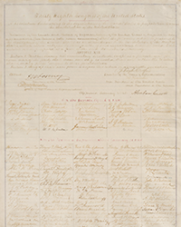
Old World Auctions (Sept 11): Lot 732. Early Announcement of Continental Congress' Declaration of Independence (1776) Est. $12,000 - $15,000
Old World Auctions (Sept 11): Lot 361. One of Ortelius' Most Decorative Maps in Full Contemporary Color (1585) Est. $9,500 - $12,000
Old World Auctions (Sept 11): Lot 55. Early Edition of One of the Most Important 16th Century Maps of the New World (1545) Est. $6,000 - $7,500
Old World Auctions (Sept 11): Lot 27. Fascinating Japanese Satirical Map of the World Published After WWI (1924) Est. $2,750 - $3,500
Old World Auctions (Sept 11): Lot 637. Complete Example of De Bry's Petits Voyages, Part VIII (1606) Est. $4,750 - $5,500
Old World Auctions (Sept 11): Lot 50. Extremely Rare Uncut Sheet from Sylvanus's 1511 Edition of Ptolemy's Geographia (1511) Est. $2,000 - $2,300
Old World Auctions (Sept 11): Lot 399. One of the Most Desired Maps of Ireland by John Speed (1610) Est. $2,750 - $3,500
Old World Auctions (Sept 11): Lot 689. Pictorial Map of Melbourne in the Style of MacDonald Gill (1934) Est. $900 - $1,100
Old World Auctions (Sept 11): Lot 652. Blaeu's Carte-a-Figures Map of Africa in Full Contemporary Color (1663) Est. $3,000 - $3,750
Old World Auctions (Sept 11): Lot 729. Hand-Colored Image of David Handing the Letter to Uriah (1518) Est. $1,000 - $1,300
Old World Auctions (Sept 11): Lot 533. Eight-Volume Set Recounting Travels of Anacharsis in Greece (1789) Est. $800 - $950