Auction Reports
Peter Arnold
Auction Info
- Auction Name
- Maps, from seven vendors
- Auction Date
- 08/12/2026 - 08/12/2026
- Sale Number
- #81226
- Total Lots
- 144
- Sold Lots
- 78.0
- Lots Sold
- 54.17%
- Unsold Lots
- 66
- Total Sales (AUD)
- 190,449.00
- Low Estimate of Lots Sold (AUD)
- 123,300.00
- High Estimate of Lots Sold (AUD)
- 161,500.00
- Low Estimate of All Lots (AUD)
- 185,000.00
- High Estimate of All Lots (AUD)
- 243,900.00
- Total Sales as a % of High Est.
- 78.08%
Top twenty five by sale price
| Lot Number | Author Name | Book Title | Year Published | Estimate | Actual Price |
|---|---|---|---|---|---|
| 105 | Russell Robert | Map shewing the site of Melbourne and the position of the huts and buildings |
1837 | AUD 6,000.00 - 8,000.00 | AUD 20,320.00 |
| 78 | Linschoten Jan Huygen van; Langren Hendrik | Exacta & accurata delineatio cum orarum maritimarum tum etiam locorum terrestrium |
1596 | AUD 2,600.00 - 3,000.00 | AUD 9,525.00 |
| 123 | Thornton John | A draught of the coast of New Holland and parts adjacent |
1708 | AUD 8,000.00 - 10,000.00 | AUD 9,525.00 |
| 118 | Stirling James | Chart of Swan River |
1829 | AUD 8,000.00 - 10,000.00 | AUD 9,525.00 |
| 67 | Hondius Henricus; Jansson Jan | Nova totius terrarum orbis geographica ac hydrographica tabula |
1630; 1633 | AUD 7,000.00 - 9,000.00 | AUD 8,255.00 |
| 99 | Proeschel Frederick | Atlas containing a map of Australasia |
circa 1863 | AUD 6,000.00 - 8,000.00 | AUD 8,255.00 |
| 51 | Freycinet Louis Claude de | Carte generale de la Nouvelle Hollande |
1811 | AUD 4,000.00 - 5,000.00 | AUD 8,255.00 |
| 79 | Lodewijcksz Willem | Descriptio hydrographica accomodata ad Battavorum navigatione in Javam insulum Indiae Orientalis |
1599 | AUD 6,000.00 - 8,000.00 | AUD 6,985.00 |
| 36 | Coronelli Vincenzo | Suite of globe gores of part of the Southern Hemisphere |
1688; circa 1693 | AUD 4,000.00 - 6,000.00 | AUD 6,350.00 |
| 41 | Dawes William | Sketch of Sydney Cove, Port Jackson, in the County of Cumberland, New South Wales |
1789 | AUD 1,200.00 - 1,500.00 | AUD 5,588.00 |
| 92 | Ottens Reiner; Ottens Joshua | Orientaliora Indiarum Orientalium cum insulis adjacentibus |
1745 | AUD 3,000.00 - 4,000.00 | AUD 5,334.00 |
| 38 | Cross Joseph | Chart of part of New South Wales with plans of the harbours |
1827; 1829 | AUD 4,000.00 - 5,000.00 | AUD 4,826.00 |
| 61 | Hayes John | A chart of Van Diemen’s Land |
1798 | AUD 4,000.00 - 5,000.00 | AUD 4,826.00 |
| 9 | ARROWSMITH John | Map shewing the surveyed lands of Port Phillip |
1843 | AUD 2,600.00 - 3,000.00 | AUD 4,572.00 |
| 59 | Ham Thomas | Map of the settled district of Melbourne |
1853 | AUD 2,000.00 - 3,000.00 | AUD 4,318.00 |
| 98 | Proeschel Frederick | General, agricultural & gold fields map of Victoria |
1860 | AUD 1,500.00 - 2,000.00 | AUD 4,318.00 |
| 91 | Ortelius Abraham | Typus orbis terrarum |
1608 | AUD 3,000.00 - 4,000.00 | AUD 3,810.00 |
| 8 | ARROWSMITH John | Map shewing the surveyed lands of Port Phillip |
1841 | AUD 3,000.00 - 4,000.00 | AUD 3,556.00 |
| 6 | ARROWSMITH John | Plan of Dutigalla, Port Phillip and Bass Strait |
1836 | AUD 2,000.00 - 2,500.00 | AUD 3,556.00 |
| 97 | Proeschel Frederick | General, agricultural & gold fields map of Victoria |
circa 1859 | AUD 1,500.00 - 2,000.00 | AUD 3,302.00 |
Back
-

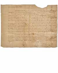
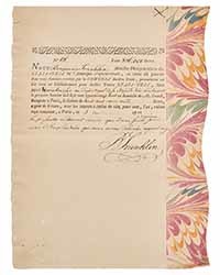
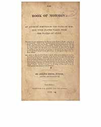

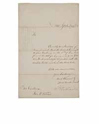
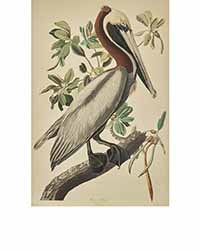
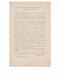 Freeman’s, August 20. President Washington Reaffirms the US Treaty of Friendship and Peace with Morocco, the Longest Unbroken Treaty in US History. $50,000 – 80,000.Freeman’s, August 20. Weeks After Victory at Yorktown, Benjamin Franklin Promises Repayment of a French Loan that Funded the American Revolution. $200,000 – 300,000.Freeman’s, August 20. Rare First Edition of the Foundational Text of the Mormon Church. $100,000 – 150,000.Freeman’s, August 20. President Washington Sends the First Major Law Passed by Congress, the Tariff Act of 1789. $100,000 – 150,000.Freeman’s, August 20. A Scarce Example of Audubon's Depiction of a Brown Pelican, Plate CCLI from his Birds of America. $30,000 – 50,000.Freeman’s, August 20. The Official and First Obtainable Broadside Printing of the Lincoln's Final Emancipation Proclamation. $30,000 – 50,000.
 -