-

 A large collection of over 300 original woodblocks of engravings for various books, v.d., with Hassall's engraver's glass water-globe (Qty) - Est. £10,000-15,000")
 & Edith Emma Cooper], \"Michael Field.\" <i>Whym Chow, Flame of Love,</i> one of only 27 copies, inscribed by Bradley, the rarest book from the press, 1914. - Est. £3,000-4,000")
] [Wood Engravings], 71 wood-engravings printed by David Chambers from the original blocks, the only set on Japanese Hosho paper, from an edition of 5 sets, [1970]. - Est. £3,000-4,000")

 <i>Contes et Nouvelles en vers,</i> 2 vol., engraved plates after Eisen, fine early 19th century blue morocco, gilt, by Bradel l'ainé, Amsterdam [Paris], 1762. - Est. £2,000-3,000")
; Their Names and Addresses, Qualities and Faults...,</i> [Paris], privately printed at the Press of the Prefecture de Police, 1883. - Est. £3,000-4,000")
 & Lucien Pissarro. <i>De la Typographie et de l'Harmonie de la Page Imprimée…,</i> [one of 216 copies], bound in dark blue morocco tooled in gilt, by Sarah T.Prideaux, 1898. - Est. £1,000-1,500")

 <i>Illustrations of the Bible,</i> complete set of 20 mezzotints, good impressions, rarely found in early states, [c.1831-1835]. - Est. £1,000-1,500")
,</i> one of 500 copies, Mary Gill's copy, Waltham St. Lawrence, 1931 with a signed proof of engraving on japon numbered 10/10 (2) - Est. £5,000-7,000")
 <i>The Decameron,</i> 3 vol., vol.1 extra-illustrated by John Buckland Wright with c.150 erotic original drawings in pen & ink and pencil, 1886 [extra-illustrated c.1940]. - Est. £10,000-15,000")

 Collection of Gogmagog Press Books, 35 vol., rare complete collection of printed books issued by the press, limited editions, most signed by Cox, 1957-83. - Est. £10,000-15,000")
] [Comedie...], [Paris, Josse Badius: sold in London by Wynkyn de Worde, & others], [15 July 1504]. - Est. £4,000-6,000")
 Ornamented Types. Twenty-Three Alphabets from the Foundry of Louis John Pouchée, 2 vol., one of 10 copies for presentation, from an edition of 210, 1992-93. - Est. £1,000-2,000")
Forum Auctions
The Private Library:
Fine Printing & Private Press books, the collection of the late David Chambers
July 9, 2026Forum, July 9: Hassall (Joan) A large collection of over 300 original woodblocks of engravings for various books, v.d., with Hassall's engraver's glass water-globe (Qty) - Est. £10,000-15,000Forum, July 9: Eragny Press.- [Bradley (Katherine Harris) & Edith Emma Cooper], "Michael Field." Whym Chow, Flame of Love, one of only 27 copies, inscribed by Bradley, the rarest book from the press, 1914. - Est. £3,000-4,000Forum, July 9: [Moore (Thomas Sturge)] [Wood Engravings], 71 wood-engravings printed by David Chambers from the original blocks, the only set on Japanese Hosho paper, from an edition of 5 sets, [1970]. - Est. £3,000-4,000Forum Auctions
The Private Library:
Fine Printing & Private Press books, the collection of the late David Chambers
July 9, 2026Forum, July 9: La Fontaine (Jean de) Contes et Nouvelles en vers, 2 vol., engraved plates after Eisen, fine early 19th century blue morocco, gilt, by Bradel l'ainé, Amsterdam [Paris], 1762. - Est. £2,000-3,000Forum, July 9: Erotica.- Prostitution.- Pretty Women of Paris (The); Their Names and Addresses, Qualities and Faults..., [Paris], privately printed at the Press of the Prefecture de Police, 1883. - Est. £3,000-4,000Forum, July 9: Vale Press.- Ricketts (Charles) & Lucien Pissarro. De la Typographie et de l'Harmonie de la Page Imprimée…, [one of 216 copies], bound in dark blue morocco tooled in gilt, by Sarah T.Prideaux, 1898. - Est. £1,000-1,500Forum Auctions
The Private Library:
Fine Printing & Private Press books, the collection of the late David Chambers
July 9, 2026Forum, July 9: Martin (John) Illustrations of the Bible, complete set of 20 mezzotints, good impressions, rarely found in early states, [c.1831-1835]. - Est. £1,000-1,500Forum, July 9: Golden Cockerel Press.- Four Gospels of the Lord Jesus Christ (The), one of 500 copies, Mary Gill's copy, Waltham St. Lawrence, 1931 with a signed proof of engraving on japon numbered 10/10 (2) - Est. £5,000-7,000Forum, July 9: Boccaccio (Giovanni) The Decameron, 3 vol., vol.1 extra-illustrated by John Buckland Wright with c.150 erotic original drawings in pen & ink and pencil, 1886 [extra-illustrated c.1940]. - Est. £10,000-15,000Forum Auctions
The Private Library:
Fine Printing & Private Press books, the collection of the late David Chambers
July 9, 2026Forum, July 9: Cox (Morris) Collection of Gogmagog Press Books, 35 vol., rare complete collection of printed books issued by the press, limited editions, most signed by Cox, 1957-83. - Est. £10,000-15,000Forum, July 9: Wynkyn de Worde.- [Terentius Afer (Publius)] [Comedie...], [Paris, Josse Badius: sold in London by Wynkyn de Worde, & others], [15 July 1504]. - Est. £4,000-6,000Forum, July 9: Mosley (James) Ornamented Types. Twenty-Three Alphabets from the Foundry of Louis John Pouchée, 2 vol., one of 10 copies for presentation, from an edition of 210, 1992-93. - Est. £1,000-2,000 -
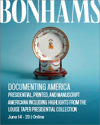


 Bonhams, June 14-23: Franklin D. Roosevelt Presentation Gold Pocket Watch. Estimate: $20,000 - 30,000Bonhams, June 14-23: Presentation Copy of the First Issue of the Lincoln Douglas Debates Signed by Abraham Lincoln in Pencil to a Sangamon County Illinois Republican. Estimate: $150,000 - 250,000Bonhams, June 14-23: A Senate Resolution Signed in the Tense Days After the Union's Humiliating Defeat at the First Battle of Bull Run. Estimate: $80,000 - $120,000Bonhams, June 14-23: Seven Passages to a Flight, an Artists Book with a Story Quilt by Faith Ringgold, the Publisher's Own Copy. Estimate: $80,000 - 120,000Bonhams, June 14-23: A New Charter for Virginia, A Response to the First Armed Rebellion in the American Colonies. Estimate: $15,000 - 25,000Bonhams, June 14-23: Earliest obtainable printing of the Bill of Rights. Estimate: $8,000 - 12,000Bonhams, June 14-23: Edward Curtis Orotone. Estimate: $7,000 - 9,000Bonhams, June 14-23: Owned by Jacqueline Kennedy Onassis: A Butter or Dessert Plate from FDR's State Dinner Service. Estimate: $3,000 - 5,000Bonhams, June 14-23: An Early Large-Format Plan of the City of Washington. Estimate: $1,500 - 2,500Bonhams, June 14-23: Containing the First Map to Name the Hudson River. Estimate: $20,000 - 30,000Bonhams, June 14-23: America's First Major Novelist, a Complete Chapter in Autograph Manuscript by James Fenimore Cooper. Estimate: $15,000 - 20,000Bonhams, June 14-23: The Only Full-Length Book by Jefferson, with the Justly Famous Map. Estimate: $12,000 - 18,000
 -


June 25, 2026 Doyle, June 25: Houdini's biography, boldly signed. $3,000 to $5,000.Doyle, June 25: A volume from Abraham Lincoln's library, signed just before heading to Washington for his inauguration. $20,000 to $30,000.Doyle, June 25: A very early Confederate recruiting manual belonging to the chief commissary in Lee's Army. $600 to $800.Doyle, June 25: Rare hand-colored lithographs of the life of Napoleon. $20,000 to $30,000.Doyle, June 25: The "Holster Atlas" of the American Revolution. $5,000 to $8,000.Doyle, June 25: Jewish ceremonies in fine hand-colored engravings. $7,000 to $10,000.Doyle, June 25: A very rare work on Turkish military costume. $1,000 to $1,500.June 25, 2026 Doyle, June 25: The most important illustrated work on the Mexican-American War. $10,000 to $15,000.Doyle, June 25: The finest illustrated book on Afghanistan. $10,000 to $15,000.Doyle, June 25: Henry Justice Ford St. George rescues the Princess from the horrible Dragon. $2,000 to $3,000.Doyle, June 25: A rare work of Prussian Army uniforms under Frederick William II, with exquisite hand-colored engravings. $800 to $1,200.Doyle, June 25: Lenny Bruce typed letter signed to a Village bohemian during his obscenity trials, with a manuscript note and drawing. $300 to $500.Doyle, June 25: Schiff's scarce Shanghai Sketchbook. $300 to $500.Doyle, June 25: The first accurate published representation of the American flag. $2,000 to $4,000. -


 Bonhams, June 14-23: Palm-reading, astrology, and more. Estimate: $2,000 - 3,000Bonhams, June 14-23: Benjamin Franklin. Sammelband of 45 papers on electricity. Estimate: $8,000 - 12,000Bonhams, June 14-23: The basis for the whole modern electric-power industry. Estimate: $4,000 - 6,000Bonhams, June 14-23: Edgar Allen Poe. Poe on Mesmerism. Estimate: $2,500 - 3,500Bonhams, June 14-23: Reformation - The Architect of Lutheranism on Church Unity and Dissent. Estimate: $100,000 - 150,000Bonhams, June 14-23: The Rare 3-Paper Offprint Identifying the Double Helix Structure of DNA, Signed by Crick, Wilkins, Wilson, Stokes and Gosling. Estimate: $40,000 - 60,000Bonhams, June 14-23: Autograph book and Report from the Thirtieth Indian National Congress, featuring the signatures of Mahatma Gandhi, Rabindranath Tagore, and Dadabhai Naoroji. Estimate: $6,000 - 8,000Bonhams, June 14-23: An Illustrated Miniature Hebrew Prayerbook Manuscript. Estimate: $30,000 - 50,000Bonhams, June 14-23: Autograph Working Draft of Arthur Conan Doyle's The Death Voyage. Estimate: $30,000 - 50,000Bonhams, June 14-23: "Perhaps the most celebrated and most beautiful herbal ever published." Estimate: $15,000 - 20,000Bonhams, June 14-23: Izaak Walton. The Compleat Angler or the Contemplative man's Recreation. Being a Discourse of Fish and Fishing. Estimate: $12,000 - 18,000Bonhams, June 14-23: A rare product of the Jaquard loom. Estimate: $8,000 - 12,000
Rare Book Monthly
Book Catalogue Reviews - August - 2006 Issue
Early American Maps and Atlases from Martayan Lan

American maps and atlases from Martayan Lan.
By Michael Stillman
New York map seller Martayan Lan has issued a catalogue of special interest to collectors in the field of Americana. Catalogue 39 is called Fine Maps of America and Atlases, and if you are planning a cross-country trip, what is offered herein won't be of much help. The newest maps are from the 19th century, while most are older. A few go back as far as the early 16th century, when the pilgrim's landing was still a century away. The North American continent turned out looking much different from what was once believed, so following these will surely get you lost. Nonetheless, these maps provide a fascinating look at history, as European explorers slowly figured out what this new, large landmass really looked like.
As you look through the evolution of maps offered, you will find New England and Florida to be among the first areas to be mapped in forms reasonably similar to what we know today. The entire Atlantic coast filled in quickly. The Pacific coast took much longer, as it was less frequently explored. It was not until a few decades into the 18th century that depictions of California as an island finally disappeared. On many maps, the entire Northwest was simply a blank slate.
The most difficult areas to map were those of the inland continent. Voyagers could do a reasonably accurate job on the coastline, but early on, had to rely on Indians for news about what existed inland. Mapmakers back in Europe would then use Indian reports, or perhaps rumors and explorers' imaginations, to depict what existed inland. Sometimes they would come away with reasonable interpretations of what would later be observed, such as lakes or mountains. Other times, they would show the most fanciful of features. Many early maps depicted an inland sea, an extension of the Pacific Ocean, reaching all of the way from the west coast to the Carolinas. North America, at this point, was just a narrow strip of land. Of course, this not only turned out to be false, but there are no features even remotely resembling this. The imaginary sea may have come from a misinterpretation of barrier islands, explorers thinking the water between them and the coast was an arm of the Pacific.
It is always very difficult to write about map catalogues. Books can be readily described with words. Maps require images. We will mention a few items you will find in this catalogue, but issue the caveat that you need to either obtain a copy yourself, or go to Martayan Lan's website, to appreciate the wonderful, historic maps they have to offer.
Item 7 is a striking, early 17th century map of the Americas by Dutch mapmaker Jodocus Hondius. At this time, the Dutch were still actively involved in the exploration and settlement of North America (remember New Amsterdam?). Hondius presents a reasonably accurate image, though North America has been squashed, becoming much wider east to west then it proved to be. He also incorporates the early belief in a huge southern polar continent. It reaches all the way to the tip of South America, Hondius somehow ignoring what he learned from Drake's voyage around the Horn. However, Hondius, like other early mapmakers, had California right, showing it (including Baja) as a peninsula, rather than an island. It would not be separated from the mainland until later in that century. Priced at $8,500.
Rare Book Monthly
-


Scandinavian Art & Rare Book Auctions
Bøker & Manuskripter
Fine Books & Manuscripts
June 24, 2026SD Auctions, June 24: [HENRIK IBSEN] BRYNJOLF BJARME: «Catilina», 1850. Originalt hvitt omslag.SD Auctions, June 24: PAULUS OROSIUS + Pseudo SENACA: «Historiae adversus paganos...», 1491. CIRCULAR WORLD MAP, SHIRLEY NUMBER 15.SD Auctions, June 24: OLAUS MAGNUS: «Historia Delle Genti Et Della Natura [...].», 1565.Scandinavian Art & Rare Book Auctions
Bøker & Manuskripter
Fine Books & Manuscripts
June 24, 2026SD Auctions, June 24: AXEL HEIBERG: Pengekiste, 17-1800-tall.SD Auctions, June 24: HENRIK IBSEN: Teaterplakater 2 stk. «FRU INGER TIL ØSTRÅT» 1895-1896.SD Auctions, June 24: HENRIK WERGELAND: Stort manuskript, signert + dedikasjonseksemplar, 1845. -


 Freeman’s, June 30. Thomas Jefferson’s “Birth of the New Nation” letter, carried to Paris with the Treaty of Peace, by a Jewish patriot. $100,000-200,000.Freeman’s, June 30. “The rockets’ red glare.” A British midshipman’s log recording the bombardment of Fort McHenry. $60,000-80,000.Freeman’s, June 30. The Critical Promotion of a Naval Hero, Oliver Hazard Perry Commission signed by James Madison, 1812. $40,000-60,000.Freeman’s, June 30. Born in the USA: First Day of Printing in the United States, July 4, 1776. $15,000-25,000.Freeman’s, June 30. One of the Earliest Printed Announcements of American Independence, in the Exceedingly Rare Original Wrappers, 1776. $10,000-15,000.Freeman’s, June 30. "The Two Big Guns of the N.Y. Yanks": A Striking Type 1 Press Photograph of Lou Gehrig's Hands. $8,000-12,000.Freeman’s, June 30. A Unique Contemporary Manuscript Account of Joseph Smith's Final Words to His Followers, the Day Before his Violent Death. $8,000-12,000.Freeman’s, June 30. The State of Minnesota Officially Certifies the Fourteenth Amendment to the Constitution Of the United States. $8,000-12,000.Freeman’s, June 30. Extraordinarily Large Manuscript Petition Signed by a Who's Who of Colonial New York to Queen Anne from the Colony of New York. $8,000-12,000.Freeman’s, June 30. Mickey Mantle's First Cover: The Earliest Front-Page Newspaper Image of Mickey Mantle, "Something Good from Joplin". $8,000-12,000.Freeman’s, June 30. A Call to Arms in the Months Following the Declaration of Independence: An Early Continental Army Recruitment Poster. $6,000-9,000.Freeman’s, June 30. Samuel Jones, the Statesman Behind the Newly Discovered "Jones Declaration": His Annotated Set Used in His Working Law Library. $6,000-9,000.
 -


. $50,000 to $70,000.")
. \"One of the new nation's most important contributions to the theory of government”. $150,000 to $180,000.")

. A Sammelband of two of Benjamin Franklin's rarest imprints. $70,000 to $100,000.")

Sotheby’s
Fine Books & Manuscripts
June 24-25Sotheby’s, June 25: Keats, John. The most significant collection of Keats’s love letters to come to market since 1885. $1,500,000 to $2,500,000.Sotheby’s, June 25: Chassériau, Benoît. The “Expedicion secreta” of the Free State of Cartagena de Indias against the forts of Portobelo (Panama). $50,000 to $70,000.Sotheby’s, June 25: (Hamilton, Alexander, James Madison, and John Jay). "One of the new nation's most important contributions to the theory of government”. $150,000 to $180,000.Sotheby’s, June 24: Benjamin Franklin. "the Day of the Declaration of Independence is everywhere annually celebrated". $80,000 to $120,000.Sotheby’s, June 24: (Johann Conrad Beissel). A Sammelband of two of Benjamin Franklin's rarest imprints. $70,000 to $100,000.Sotheby’s, June 25: [Pernambuco]. First printed work in favor of Brazilian Independence. $150,000 to $200,000.