OldMaps.com: OldMaps Shared Auction, OM-SHARED, NoData
Auction Details
- Auction Date
- February 07, 2025 - February 07, 2025
-


Sotheby’s
Shelf Life: Books, Manuscripts and Works on Paper from the Library of Stanley J. Seeger and Christopher Cone
25 June – July 7Sotheby’s, July 7: Ludwig van Beethoven. Autograph sketches for the overture "Die Weihe des Hauses", op.124, [1822], UNPUBLISHED. £150,000 to £200,000.Sotheby’s, July 7: Jane Austen. Pride and Prejudice, 1813, first edition, 3 volumes, contemporary half calf. £50,000 to £70,000.Sotheby’s, July 7: Walt Whitman. Leaves of Grass, Brooklyn, 1855, first edition, first issue, original green cloth, the Doheny copy. £50,000 to £70,000.Sotheby’s, July 7: Binding—Sangorski & Sutcliffe—Omar Khayyam. Rubaiyat, London, 1872, third edition, in a magnificent jewelled Peacock binding. £15,000 to £20,000.Sotheby’s, July 7: George Eliot. Middlemarch, Edinburgh and London, 1871, first edition in the original parts. £20,000 to £30,000. -

 A large collection of over 300 original woodblocks of engravings for various books, v.d., with Hassall's engraver's glass water-globe (Qty) - Est. £10,000-15,000")
 & Edith Emma Cooper], \"Michael Field.\" <i>Whym Chow, Flame of Love,</i> one of only 27 copies, inscribed by Bradley, the rarest book from the press, 1914. - Est. £3,000-4,000")
] [Wood Engravings], 71 wood-engravings printed by David Chambers from the original blocks, the only set on Japanese Hosho paper, from an edition of 5 sets, [1970]. - Est. £3,000-4,000")

 <i>Contes et Nouvelles en vers,</i> 2 vol., engraved plates after Eisen, fine early 19th century blue morocco, gilt, by Bradel l'ainé, Amsterdam [Paris], 1762. - Est. £2,000-3,000")
; Their Names and Addresses, Qualities and Faults...,</i> [Paris], privately printed at the Press of the Prefecture de Police, 1883. - Est. £3,000-4,000")
 & Lucien Pissarro. <i>De la Typographie et de l'Harmonie de la Page Imprimée…,</i> [one of 216 copies], bound in dark blue morocco tooled in gilt, by Sarah T.Prideaux, 1898. - Est. £1,000-1,500")

 <i>Illustrations of the Bible,</i> complete set of 20 mezzotints, good impressions, rarely found in early states, [c.1831-1835]. - Est. £1,000-1,500")
,</i> one of 500 copies, Mary Gill's copy, Waltham St. Lawrence, 1931 with a signed proof of engraving on japon numbered 10/10 (2) - Est. £5,000-7,000")
 <i>The Decameron,</i> 3 vol., vol.1 extra-illustrated by John Buckland Wright with c.150 erotic original drawings in pen & ink and pencil, 1886 [extra-illustrated c.1940]. - Est. £10,000-15,000")

 Collection of Gogmagog Press Books, 35 vol., rare complete collection of printed books issued by the press, limited editions, most signed by Cox, 1957-83. - Est. £10,000-15,000")
] [Comedie...], [Paris, Josse Badius: sold in London by Wynkyn de Worde, & others], [15 July 1504]. - Est. £4,000-6,000")
 Ornamented Types. Twenty-Three Alphabets from the Foundry of Louis John Pouchée, 2 vol., one of 10 copies for presentation, from an edition of 210, 1992-93. - Est. £1,000-2,000")
Forum Auctions
The Private Library:
Fine Printing & Private Press books, the collection of the late David Chambers
July 9, 2026Forum, July 9: Hassall (Joan) A large collection of over 300 original woodblocks of engravings for various books, v.d., with Hassall's engraver's glass water-globe (Qty) - Est. £10,000-15,000Forum, July 9: Eragny Press.- [Bradley (Katherine Harris) & Edith Emma Cooper], "Michael Field." Whym Chow, Flame of Love, one of only 27 copies, inscribed by Bradley, the rarest book from the press, 1914. - Est. £3,000-4,000Forum, July 9: [Moore (Thomas Sturge)] [Wood Engravings], 71 wood-engravings printed by David Chambers from the original blocks, the only set on Japanese Hosho paper, from an edition of 5 sets, [1970]. - Est. £3,000-4,000Forum Auctions
The Private Library:
Fine Printing & Private Press books, the collection of the late David Chambers
July 9, 2026Forum, July 9: La Fontaine (Jean de) Contes et Nouvelles en vers, 2 vol., engraved plates after Eisen, fine early 19th century blue morocco, gilt, by Bradel l'ainé, Amsterdam [Paris], 1762. - Est. £2,000-3,000Forum, July 9: Erotica.- Prostitution.- Pretty Women of Paris (The); Their Names and Addresses, Qualities and Faults..., [Paris], privately printed at the Press of the Prefecture de Police, 1883. - Est. £3,000-4,000Forum, July 9: Vale Press.- Ricketts (Charles) & Lucien Pissarro. De la Typographie et de l'Harmonie de la Page Imprimée…, [one of 216 copies], bound in dark blue morocco tooled in gilt, by Sarah T.Prideaux, 1898. - Est. £1,000-1,500Forum Auctions
The Private Library:
Fine Printing & Private Press books, the collection of the late David Chambers
July 9, 2026Forum, July 9: Martin (John) Illustrations of the Bible, complete set of 20 mezzotints, good impressions, rarely found in early states, [c.1831-1835]. - Est. £1,000-1,500Forum, July 9: Golden Cockerel Press.- Four Gospels of the Lord Jesus Christ (The), one of 500 copies, Mary Gill's copy, Waltham St. Lawrence, 1931 with a signed proof of engraving on japon numbered 10/10 (2) - Est. £5,000-7,000Forum, July 9: Boccaccio (Giovanni) The Decameron, 3 vol., vol.1 extra-illustrated by John Buckland Wright with c.150 erotic original drawings in pen & ink and pencil, 1886 [extra-illustrated c.1940]. - Est. £10,000-15,000Forum Auctions
The Private Library:
Fine Printing & Private Press books, the collection of the late David Chambers
July 9, 2026Forum, July 9: Cox (Morris) Collection of Gogmagog Press Books, 35 vol., rare complete collection of printed books issued by the press, limited editions, most signed by Cox, 1957-83. - Est. £10,000-15,000Forum, July 9: Wynkyn de Worde.- [Terentius Afer (Publius)] [Comedie...], [Paris, Josse Badius: sold in London by Wynkyn de Worde, & others], [15 July 1504]. - Est. £4,000-6,000Forum, July 9: Mosley (James) Ornamented Types. Twenty-Three Alphabets from the Foundry of Louis John Pouchée, 2 vol., one of 10 copies for presentation, from an edition of 210, 1992-93. - Est. £1,000-2,000 -


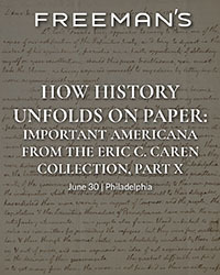


 Freeman’s, June 30. Thomas Jefferson’s “Birth of the New Nation” letter, carried to Paris with the Treaty of Peace, by a Jewish patriot. $100,000-200,000.Freeman’s, June 30. “The rockets’ red glare.” A British midshipman’s log recording the bombardment of Fort McHenry. $60,000-80,000.Freeman’s, June 30. The Critical Promotion of a Naval Hero, Oliver Hazard Perry Commission signed by James Madison, 1812. $40,000-60,000.Freeman’s, June 30. Born in the USA: First Day of Printing in the United States, July 4, 1776. $15,000-25,000.Freeman’s, June 30. One of the Earliest Printed Announcements of American Independence, in the Exceedingly Rare Original Wrappers, 1776. $10,000-15,000.Freeman’s, June 30. "The Two Big Guns of the N.Y. Yanks": A Striking Type 1 Press Photograph of Lou Gehrig's Hands. $8,000-12,000.Freeman’s, June 30. A Unique Contemporary Manuscript Account of Joseph Smith's Final Words to His Followers, the Day Before his Violent Death. $8,000-12,000.Freeman’s, June 30. The State of Minnesota Officially Certifies the Fourteenth Amendment to the Constitution Of the United States. $8,000-12,000.Freeman’s, June 30. Extraordinarily Large Manuscript Petition Signed by a Who's Who of Colonial New York to Queen Anne from the Colony of New York. $8,000-12,000.Freeman’s, June 30. Mickey Mantle's First Cover: The Earliest Front-Page Newspaper Image of Mickey Mantle, "Something Good from Joplin". $8,000-12,000.Freeman’s, June 30. A Call to Arms in the Months Following the Declaration of Independence: An Early Continental Army Recruitment Poster. $6,000-9,000.Freeman’s, June 30. Samuel Jones, the Statesman Behind the Newly Discovered "Jones Declaration": His Annotated Set Used in His Working Law Library. $6,000-9,000.