-


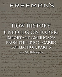


 Freeman’s, June 30. Thomas Jefferson’s “Birth of the New Nation” letter, carried to Paris with the Treaty of Peace, by a Jewish patriot. $100,000-200,000.Freeman’s, June 30. “The rockets’ red glare.” A British midshipman’s log recording the bombardment of Fort McHenry. $60,000-80,000.Freeman’s, June 30. The Critical Promotion of a Naval Hero, Oliver Hazard Perry Commission signed by James Madison, 1812. $40,000-60,000.Freeman’s, June 30. Born in the USA: First Day of Printing in the United States, July 4, 1776. $15,000-25,000.Freeman’s, June 30. One of the Earliest Printed Announcements of American Independence, in the Exceedingly Rare Original Wrappers, 1776. $10,000-15,000.Freeman’s, June 30. "The Two Big Guns of the N.Y. Yanks": A Striking Type 1 Press Photograph of Lou Gehrig's Hands. $8,000-12,000.Freeman’s, June 30. A Unique Contemporary Manuscript Account of Joseph Smith's Final Words to His Followers, the Day Before his Violent Death. $8,000-12,000.Freeman’s, June 30. The State of Minnesota Officially Certifies the Fourteenth Amendment to the Constitution Of the United States. $8,000-12,000.Freeman’s, June 30. Extraordinarily Large Manuscript Petition Signed by a Who's Who of Colonial New York to Queen Anne from the Colony of New York. $8,000-12,000.Freeman’s, June 30. Mickey Mantle's First Cover: The Earliest Front-Page Newspaper Image of Mickey Mantle, "Something Good from Joplin". $8,000-12,000.Freeman’s, June 30. A Call to Arms in the Months Following the Declaration of Independence: An Early Continental Army Recruitment Poster. $6,000-9,000.Freeman’s, June 30. Samuel Jones, the Statesman Behind the Newly Discovered "Jones Declaration": His Annotated Set Used in His Working Law Library. $6,000-9,000.
 -


. Washington decries “an ostentatious imitation, or mimickry of Royalty” in his Presidency. $250,000 to $500,000.")
, pièce composée en 1610. €40,000 to €60,000.")
Sotheby's Book Week
2 June - 9 JulySotheby’s, June 25: Smith, Adam. The Wealth of Nations, on its 250th anniversary. $180,000 to $250,000.Sotheby’s, June 17: Fontana, Lucio. Concetto Spaziale. 1967. Leporello en papier doré. Bel exemplaire signé. €4,000 to $€,000.Sotheby’s, June 25: Fitzgerald, F. Scott. "So we beat on, boats against the current, borne back ceaselessly into the past”. $150,000 to $200,000.Sotheby’s, June 25: Washington, George (as First President). Washington decries “an ostentatious imitation, or mimickry of Royalty” in his Presidency. $250,000 to $500,000.Sotheby’s, June 17: Lope de Vega. Rare manuscrit autographe signé de la préface dédicatoire de "El Cardenal de Belen" (le cardinal de Bethléem), pièce composée en 1610. €40,000 to €60,000. -

publisher & Kerver (Thielman)printer. <i>Regimen Sanitatis Salernitanum,</i> sm. 8vo, Paris [1498]")
 [Wraxall (Lascelles)]. <i>Les Miserable,</i> 3 vols., 8vo, L. (Hurst & Blackett) 1862, First Authorized English Translation (copyright).")
. <i>Frankenstein: or The Modern Prometheus,</i> 8vo, 2 vols. in one, L. (G. & W.B. Whittaker, Ave-Maria-Lane) 1823.")


. <i>A Description of the Genus Pinus, with Directions Relative to the Cultivation…,</i> 2 vols. Sm. folio L. (Messrs. Weddell) 1832.")
. <i>Flora Londinensis: or Plates and Descriptions of such Plants as Grow Wild in the Environs of London,</i> 2 vols. folio, London (B. White) 1777 – 1798.")

 <i>Maple Leaves, Canadian History and Quebec Scenery</i> (Third Series) 8vo Quebec (Hunter, Rose & Co.) 1865. First Edn.")

 to an unnamed correspondent [possibly Charles-Henri de Lorraine] discussing his strategy against the French forces during the siege of Namur.")

 (1785-1817]. <i>Pride and Prejudice,</i> 3 vols. sm. 8vo, L. (T. Egerton) 1813.")
. <i>Ugolino,</i> sm. folio D. (Dolmen) 1979, Limited Edn. No. 78/125 Copies, Signed by Seamus Heaney, Louis le Brocquy, Liam Miller and Andrew Carpenter.")
. <i>Petits Ouvrages, attribues a M. de Voltaire,</i> sm. folio manuscript, dated 1776, containing 9 works.")
June 23rd, 24th & 25th 2026 Fonsie Mealy’s, June 23-25: Medical Incunabula: Petit (Jean)publisher & Kerver (Thielman)printer. Regimen Sanitatis Salernitanum, sm. 8vo, Paris [1498]Fonsie Mealy’s, June 23-25: Hugo (Victor) [Wraxall (Lascelles)]. Les Miserable, 3 vols., 8vo, L. (Hurst & Blackett) 1862, First Authorized English Translation (copyright).Fonsie Mealy’s, June 23-25: Shelley (Mary Wollstonecraft). Frankenstein: or The Modern Prometheus, 8vo, 2 vols. in one, L. (G. & W.B. Whittaker, Ave-Maria-Lane) 1823.June 23rd, 24th & 25th 2026 Fonsie Mealy’s, June 23-25: Cuisine: Anon. Cookery, Pastry, and Sweet Meats in three Books, Alphabetically Digested, 8vo 1710.Fonsie Mealy’s, June 23-25: Lambert (Aylmer Bourke). A Description of the Genus Pinus, with Directions Relative to the Cultivation…, 2 vols. Sm. folio L. (Messrs. Weddell) 1832.Fonsie Mealy’s, June 23-25: Botany: Curtis (William). Flora Londinensis: or Plates and Descriptions of such Plants as Grow Wild in the Environs of London, 2 vols. folio, London (B. White) 1777 – 1798.June 23rd, 24th & 25th 2026 Fonsie Mealy’s, June 23-25: Le Moire (J.M.) Maple Leaves, Canadian History and Quebec Scenery (Third Series) 8vo Quebec (Hunter, Rose & Co.) 1865. First Edn.Fonsie Mealy’s, June 23-25: The Earliest Extant Printed House Contents Sale Catalogue in Ireland: Baillie, Auctioneer, Abby Street. A Catalogue of the Goods and Stock of the late Edward Wingfield…Fonsie Mealy’s, June 23-25: William III King of England. Autograph Letter Signed ("William R") to an unnamed correspondent [possibly Charles-Henri de Lorraine] discussing his strategy against the French forces during the siege of Namur.June 23rd, 24th & 25th 2026 Fonsie Mealy’s, June 23-25: [Austen (Jane) (1785-1817]. Pride and Prejudice, 3 vols. sm. 8vo, L. (T. Egerton) 1813.Fonsie Mealy’s, June 23-25: Heaney (Seamus). Ugolino, sm. folio D. (Dolmen) 1979, Limited Edn. No. 78/125 Copies, Signed by Seamus Heaney, Louis le Brocquy, Liam Miller and Andrew Carpenter.Fonsie Mealy’s, June 23-25: Voltaire (F.M. Avouet de). Petits Ouvrages, attribues a M. de Voltaire, sm. folio manuscript, dated 1776, containing 9 works. -


 Bonhams, June 14-23: Franklin D. Roosevelt Presentation Gold Pocket Watch. Estimate: $20,000 - 30,000Bonhams, June 14-23: Presentation Copy of the First Issue of the Lincoln Douglas Debates Signed by Abraham Lincoln in Pencil to a Sangamon County Illinois Republican. Estimate: $150,000 - 250,000Bonhams, June 14-23: A Senate Resolution Signed in the Tense Days After the Union's Humiliating Defeat at the First Battle of Bull Run. Estimate: $80,000 - $120,000Bonhams, June 14-23: Seven Passages to a Flight, an Artists Book with a Story Quilt by Faith Ringgold, the Publisher's Own Copy. Estimate: $80,000 - 120,000Bonhams, June 14-23: A New Charter for Virginia, A Response to the First Armed Rebellion in the American Colonies. Estimate: $15,000 - 25,000Bonhams, June 14-23: Earliest obtainable printing of the Bill of Rights. Estimate: $8,000 - 12,000Bonhams, June 14-23: Edward Curtis Orotone. Estimate: $7,000 - 9,000Bonhams, June 14-23: Owned by Jacqueline Kennedy Onassis: A Butter or Dessert Plate from FDR's State Dinner Service. Estimate: $3,000 - 5,000Bonhams, June 14-23: An Early Large-Format Plan of the City of Washington. Estimate: $1,500 - 2,500Bonhams, June 14-23: Containing the First Map to Name the Hudson River. Estimate: $20,000 - 30,000Bonhams, June 14-23: America's First Major Novelist, a Complete Chapter in Autograph Manuscript by James Fenimore Cooper. Estimate: $15,000 - 20,000Bonhams, June 14-23: The Only Full-Length Book by Jefferson, with the Justly Famous Map. Estimate: $12,000 - 18,000
OldMaps.com: OldMaps Shared Auction, OM-SHARED, NoData
Auction Details
- Auction Date
- February 07, 2025 - February 07, 2025
-
:</b> Lot 123. Celebrate 250 Years of Independence with Original Stars and Stripes (1790) Est. $1,400 - $1,700")
:</b> Lot 20. Keulen's Spectacular Chart of the World Featuring California as an Island (1728) Est. $12,000 - $15,000")
:</b> Lot 42. Schedel's Ancient World Map with Fantastic Humanoid Creatures (1493) Est. $14,000 - $17,000")

:</b> Lot 591. Matching Set of 3 Stunning Globe Gores of Eastern Asia from Coronelli's 3.5 Foot Globe (1688) Est. $5,500 - $7,000")
:</b> Lot 9. Speed's Popular World Map with Allegorical Representations of the Elements (1651) Est. $14,000 - $17,000")
:</b> Lot 168. First Separate Map of Kansas & Nebraska Territories (1854) Est. $5,500 - $7,000")

:</b> Lot 43. Only Macrobius Map with Britain Attached to Europe (1515) Est. $800 - $950")
:</b> Lot 250. Rare Map of Boston and One of the Earliest Maps of the Revolutionary War (1775) Est. $2,000 - $2,300")
:</b> Lot 79. Schenk's Uncommon Map Featuring Two Figurative Title Cartouches (1696) Est. $1,200 - $1,500")
:</b> Lot 681. Hand-Colored Image of the Annunciation to the Shepherds (1502) Est. $800 - $950")
 Old World Auctions (June 17): Lot 123. Celebrate 250 Years of Independence with Original Stars and Stripes (1790) Est. $1,400 - $1,700Old World Auctions (June 17): Lot 20. Keulen's Spectacular Chart of the World Featuring California as an Island (1728) Est. $12,000 - $15,000Old World Auctions (June 17): Lot 42. Schedel's Ancient World Map with Fantastic Humanoid Creatures (1493) Est. $14,000 - $17,000Old World Auctions (June 17): Lot 591. Matching Set of 3 Stunning Globe Gores of Eastern Asia from Coronelli's 3.5 Foot Globe (1688) Est. $5,500 - $7,000Old World Auctions (June 17): Lot 9. Speed's Popular World Map with Allegorical Representations of the Elements (1651) Est. $14,000 - $17,000Old World Auctions (June 17): Lot 168. First Separate Map of Kansas & Nebraska Territories (1854) Est. $5,500 - $7,000Old World Auctions (June 17): Lot 43. Only Macrobius Map with Britain Attached to Europe (1515) Est. $800 - $950Old World Auctions (June 17): Lot 250. Rare Map of Boston and One of the Earliest Maps of the Revolutionary War (1775) Est. $2,000 - $2,300Old World Auctions (June 17): Lot 79. Schenk's Uncommon Map Featuring Two Figurative Title Cartouches (1696) Est. $1,200 - $1,500Old World Auctions (June 17): Lot 681. Hand-Colored Image of the Annunciation to the Shepherds (1502) Est. $800 - $950
 -


June 25, 2026 Doyle, June 25: Houdini's biography, boldly signed. $3,000 to $5,000.Doyle, June 25: A volume from Abraham Lincoln's library, signed just before heading to Washington for his inauguration. $20,000 to $30,000.Doyle, June 25: A very early Confederate recruiting manual belonging to the chief commissary in Lee's Army. $600 to $800.Doyle, June 25: Rare hand-colored lithographs of the life of Napoleon. $20,000 to $30,000.Doyle, June 25: The "Holster Atlas" of the American Revolution. $5,000 to $8,000.Doyle, June 25: Jewish ceremonies in fine hand-colored engravings. $7,000 to $10,000.Doyle, June 25: A very rare work on Turkish military costume. $1,000 to $1,500.June 25, 2026 Doyle, June 25: The most important illustrated work on the Mexican-American War. $10,000 to $15,000.Doyle, June 25: The finest illustrated book on Afghanistan. $10,000 to $15,000.Doyle, June 25: Henry Justice Ford St. George rescues the Princess from the horrible Dragon. $2,000 to $3,000.Doyle, June 25: A rare work of Prussian Army uniforms under Frederick William II, with exquisite hand-colored engravings. $800 to $1,200.Doyle, June 25: Lenny Bruce typed letter signed to a Village bohemian during his obscenity trials, with a manuscript note and drawing. $300 to $500.Doyle, June 25: Schiff's scarce Shanghai Sketchbook. $300 to $500.Doyle, June 25: The first accurate published representation of the American flag. $2,000 to $4,000. -


 Bonhams, June 14-23: Palm-reading, astrology, and more. Estimate: $2,000 - 3,000Bonhams, June 14-23: Benjamin Franklin. Sammelband of 45 papers on electricity. Estimate: $8,000 - 12,000Bonhams, June 14-23: The basis for the whole modern electric-power industry. Estimate: $4,000 - 6,000Bonhams, June 14-23: Edgar Allen Poe. Poe on Mesmerism. Estimate: $2,500 - 3,500Bonhams, June 14-23: Reformation - The Architect of Lutheranism on Church Unity and Dissent. Estimate: $100,000 - 150,000Bonhams, June 14-23: The Rare 3-Paper Offprint Identifying the Double Helix Structure of DNA, Signed by Crick, Wilkins, Wilson, Stokes and Gosling. Estimate: $40,000 - 60,000Bonhams, June 14-23: Autograph book and Report from the Thirtieth Indian National Congress, featuring the signatures of Mahatma Gandhi, Rabindranath Tagore, and Dadabhai Naoroji. Estimate: $6,000 - 8,000Bonhams, June 14-23: An Illustrated Miniature Hebrew Prayerbook Manuscript. Estimate: $30,000 - 50,000Bonhams, June 14-23: Autograph Working Draft of Arthur Conan Doyle's The Death Voyage. Estimate: $30,000 - 50,000Bonhams, June 14-23: "Perhaps the most celebrated and most beautiful herbal ever published." Estimate: $15,000 - 20,000Bonhams, June 14-23: Izaak Walton. The Compleat Angler or the Contemplative man's Recreation. Being a Discourse of Fish and Fishing. Estimate: $12,000 - 18,000Bonhams, June 14-23: A rare product of the Jaquard loom. Estimate: $8,000 - 12,000