-


. $50,000 to $70,000.")
. \"One of the new nation's most important contributions to the theory of government”. $150,000 to $180,000.")

. A Sammelband of two of Benjamin Franklin's rarest imprints. $70,000 to $100,000.")

Sotheby’s
Fine Books & Manuscripts
June 24-25Sotheby’s, June 25: Keats, John. The most significant collection of Keats’s love letters to come to market since 1885. $1,500,000 to $2,500,000.Sotheby’s, June 25: Chassériau, Benoît. The “Expedicion secreta” of the Free State of Cartagena de Indias against the forts of Portobelo (Panama). $50,000 to $70,000.Sotheby’s, June 25: (Hamilton, Alexander, James Madison, and John Jay). "One of the new nation's most important contributions to the theory of government”. $150,000 to $180,000.Sotheby’s, June 24: Benjamin Franklin. "the Day of the Declaration of Independence is everywhere annually celebrated". $80,000 to $120,000.Sotheby’s, June 24: (Johann Conrad Beissel). A Sammelband of two of Benjamin Franklin's rarest imprints. $70,000 to $100,000.Sotheby’s, June 25: [Pernambuco]. First printed work in favor of Brazilian Independence. $150,000 to $200,000. -

publisher & Kerver (Thielman)printer. <i>Regimen Sanitatis Salernitanum,</i> sm. 8vo, Paris [1498]")
 [Wraxall (Lascelles)]. <i>Les Miserable,</i> 3 vols., 8vo, L. (Hurst & Blackett) 1862, First Authorized English Translation (copyright).")
. <i>Frankenstein: or The Modern Prometheus,</i> 8vo, 2 vols. in one, L. (G. & W.B. Whittaker, Ave-Maria-Lane) 1823.")


. <i>A Description of the Genus Pinus, with Directions Relative to the Cultivation…,</i> 2 vols. Sm. folio L. (Messrs. Weddell) 1832.")
. <i>Flora Londinensis: or Plates and Descriptions of such Plants as Grow Wild in the Environs of London,</i> 2 vols. folio, London (B. White) 1777 – 1798.")

 <i>Maple Leaves, Canadian History and Quebec Scenery</i> (Third Series) 8vo Quebec (Hunter, Rose & Co.) 1865. First Edn.")

 to an unnamed correspondent [possibly Charles-Henri de Lorraine] discussing his strategy against the French forces during the siege of Namur.")

 (1785-1817]. <i>Pride and Prejudice,</i> 3 vols. sm. 8vo, L. (T. Egerton) 1813.")
. <i>Ugolino,</i> sm. folio D. (Dolmen) 1979, Limited Edn. No. 78/125 Copies, Signed by Seamus Heaney, Louis le Brocquy, Liam Miller and Andrew Carpenter.")
. <i>Petits Ouvrages, attribues a M. de Voltaire,</i> sm. folio manuscript, dated 1776, containing 9 works.")
June 23rd, 24th & 25th 2026 Fonsie Mealy’s, June 23-25: Medical Incunabula: Petit (Jean)publisher & Kerver (Thielman)printer. Regimen Sanitatis Salernitanum, sm. 8vo, Paris [1498]Fonsie Mealy’s, June 23-25: Hugo (Victor) [Wraxall (Lascelles)]. Les Miserable, 3 vols., 8vo, L. (Hurst & Blackett) 1862, First Authorized English Translation (copyright).Fonsie Mealy’s, June 23-25: Shelley (Mary Wollstonecraft). Frankenstein: or The Modern Prometheus, 8vo, 2 vols. in one, L. (G. & W.B. Whittaker, Ave-Maria-Lane) 1823.June 23rd, 24th & 25th 2026 Fonsie Mealy’s, June 23-25: Cuisine: Anon. Cookery, Pastry, and Sweet Meats in three Books, Alphabetically Digested, 8vo 1710.Fonsie Mealy’s, June 23-25: Lambert (Aylmer Bourke). A Description of the Genus Pinus, with Directions Relative to the Cultivation…, 2 vols. Sm. folio L. (Messrs. Weddell) 1832.Fonsie Mealy’s, June 23-25: Botany: Curtis (William). Flora Londinensis: or Plates and Descriptions of such Plants as Grow Wild in the Environs of London, 2 vols. folio, London (B. White) 1777 – 1798.June 23rd, 24th & 25th 2026 Fonsie Mealy’s, June 23-25: Le Moire (J.M.) Maple Leaves, Canadian History and Quebec Scenery (Third Series) 8vo Quebec (Hunter, Rose & Co.) 1865. First Edn.Fonsie Mealy’s, June 23-25: The Earliest Extant Printed House Contents Sale Catalogue in Ireland: Baillie, Auctioneer, Abby Street. A Catalogue of the Goods and Stock of the late Edward Wingfield…Fonsie Mealy’s, June 23-25: William III King of England. Autograph Letter Signed ("William R") to an unnamed correspondent [possibly Charles-Henri de Lorraine] discussing his strategy against the French forces during the siege of Namur.June 23rd, 24th & 25th 2026 Fonsie Mealy’s, June 23-25: [Austen (Jane) (1785-1817]. Pride and Prejudice, 3 vols. sm. 8vo, L. (T. Egerton) 1813.Fonsie Mealy’s, June 23-25: Heaney (Seamus). Ugolino, sm. folio D. (Dolmen) 1979, Limited Edn. No. 78/125 Copies, Signed by Seamus Heaney, Louis le Brocquy, Liam Miller and Andrew Carpenter.Fonsie Mealy’s, June 23-25: Voltaire (F.M. Avouet de). Petits Ouvrages, attribues a M. de Voltaire, sm. folio manuscript, dated 1776, containing 9 works. -
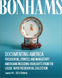


 Bonhams, June 14-23: Franklin D. Roosevelt Presentation Gold Pocket Watch. Estimate: $20,000 - 30,000Bonhams, June 14-23: Presentation Copy of the First Issue of the Lincoln Douglas Debates Signed by Abraham Lincoln in Pencil to a Sangamon County Illinois Republican. Estimate: $150,000 - 250,000Bonhams, June 14-23: A Senate Resolution Signed in the Tense Days After the Union's Humiliating Defeat at the First Battle of Bull Run. Estimate: $80,000 - $120,000Bonhams, June 14-23: Seven Passages to a Flight, an Artists Book with a Story Quilt by Faith Ringgold, the Publisher's Own Copy. Estimate: $80,000 - 120,000Bonhams, June 14-23: A New Charter for Virginia, A Response to the First Armed Rebellion in the American Colonies. Estimate: $15,000 - 25,000Bonhams, June 14-23: Earliest obtainable printing of the Bill of Rights. Estimate: $8,000 - 12,000Bonhams, June 14-23: Edward Curtis Orotone. Estimate: $7,000 - 9,000Bonhams, June 14-23: Owned by Jacqueline Kennedy Onassis: A Butter or Dessert Plate from FDR's State Dinner Service. Estimate: $3,000 - 5,000Bonhams, June 14-23: An Early Large-Format Plan of the City of Washington. Estimate: $1,500 - 2,500Bonhams, June 14-23: Containing the First Map to Name the Hudson River. Estimate: $20,000 - 30,000Bonhams, June 14-23: America's First Major Novelist, a Complete Chapter in Autograph Manuscript by James Fenimore Cooper. Estimate: $15,000 - 20,000Bonhams, June 14-23: The Only Full-Length Book by Jefferson, with the Justly Famous Map. Estimate: $12,000 - 18,000
 -


June 25, 2026 Doyle, June 25: Houdini's biography, boldly signed. $3,000 to $5,000.Doyle, June 25: A volume from Abraham Lincoln's library, signed just before heading to Washington for his inauguration. $20,000 to $30,000.Doyle, June 25: A very early Confederate recruiting manual belonging to the chief commissary in Lee's Army. $600 to $800.Doyle, June 25: Rare hand-colored lithographs of the life of Napoleon. $20,000 to $30,000.Doyle, June 25: The "Holster Atlas" of the American Revolution. $5,000 to $8,000.Doyle, June 25: Jewish ceremonies in fine hand-colored engravings. $7,000 to $10,000.Doyle, June 25: A very rare work on Turkish military costume. $1,000 to $1,500.June 25, 2026 Doyle, June 25: The most important illustrated work on the Mexican-American War. $10,000 to $15,000.Doyle, June 25: The finest illustrated book on Afghanistan. $10,000 to $15,000.Doyle, June 25: Henry Justice Ford St. George rescues the Princess from the horrible Dragon. $2,000 to $3,000.Doyle, June 25: A rare work of Prussian Army uniforms under Frederick William II, with exquisite hand-colored engravings. $800 to $1,200.Doyle, June 25: Lenny Bruce typed letter signed to a Village bohemian during his obscenity trials, with a manuscript note and drawing. $300 to $500.Doyle, June 25: Schiff's scarce Shanghai Sketchbook. $300 to $500.Doyle, June 25: The first accurate published representation of the American flag. $2,000 to $4,000.
OldMaps.com: OldMaps Shared Auction, OM-SHARED, NoData
Auction Details
- Auction Date
- February 07, 2025 - February 07, 2025
| Lot Number | Author Name | Book Title | Place Printed | Year Published | Estimate | Actual Price |
|---|---|---|---|---|---|---|
| Henry Teesdale [& Co.] | The World on Mercator's Projection | 1831 |
USD - | 50.00 | ||
| Henry Teesdale [& Co.] | The World on Mercator's Projection | 1842 |
USD - | 40.00 | ||
| Henry Teesdale [& Co.] | The World on Mercator's Projection | 1831 |
USD - | 40.00 | ||
| Henry Teesdale [& Co.] | The World on Mercator's Projection | 1832 |
USD - | 49.00 | ||
| Henry Teesdale [& Co.] | United States | c.1842 |
USD - | 60.00 | ||
| Henry Teesdale [& Co.] | United States | 1831 |
USD - | 43.00 | ||
| Henry Teesdale [& Co.] | United States | 1831 |
USD - | 61.00 | ||
| Henry Teesdale [& Co.] | United States | 1848 |
USD - | 75.00 | ||
| Henry Teesdale [& Co.] | United States | 1849 |
USD - | 55.00 | ||
| Henry Teesdale [& Co.] | United States | 1831 |
USD - | 65.00 | ||
| Henry Teesdale [& Co.] | United States | 1845 |
USD - | 150.00 | ||
| Henry Teesdale [& Co.] | United States | c.1835 |
USD - | 95.00 | ||
| Henry Teesdale [& Co.] | United States | 1845 |
USD - | 150.00 | ||
| Henry Teesdale [& Co.] | United States | c.1835 |
USD - | 150.00 | ||
| Henry Teesdale [& Co.] | United States | c.1830 |
USD - | 150.00 | ||
| Henry Teesdale [& Co.] | United States | c.1830 |
USD - | 175.00 | ||
| Henry Teesdale [& Co.] | United States | 1831 |
USD - | 39.00 | ||
| Henry Teesdale [& Co.] | Van Diemens Land | 1831 |
USD - | 65.00 | ||
| Henry Teesdale [& Co.] | Van Diemens Land | c.1850 |
USD - | 50.00 | ||
| Henry Teesdale [& Co.] | Van Diemens Land | c.1830 |
USD - | 51.00 | ||
| Henry Teesdale [& Co.] | West Indies | c.1845 |
USD - | 33.00 | ||
| Henry Teesdale [& Co.] | Western Hemisphere | 1832 |
USD - | 40.00 | ||
| Henry Teesdale [& Co.] | Western Hemisphere | 1841 |
USD - | 50.00 | ||
| Henry Teesdale [& Co.] | Western Hemisphere | 1838 |
USD - | 65.00 | ||
| Thomas Tegg | Asia from the Best Authorities | 1823 |
USD - | 20.00 | ||
| Thomas Tegg | Europe, from the Best Authorities | 1823 |
USD - | 12.00 | ||
| Thomas Tegg | Japan | 1829 |
USD - | 175.00 | ||
| Thomas Tegg | Mexico and Guatimala | 1816 |
USD - | 90.00 | ||
| Thomas Tegg | Mexico and Guatimala | 1829 |
USD - | 65.00 | ||
| Thomas Tegg | North America | c.1827 |
USD - | 35.00 | ||
| Thomas Tegg | North America from the Best Authorities | 1823 |
USD - | 33.00 | ||
| Thomas Tegg | Polar Regions Including British Nth. America, &c. | 1829 |
USD - | 55.00 | ||
| Thomas Tegg | South America from the Best Authorities | 1823 |
USD - | 16.00 | ||
| Thomas Tegg | Tegg's New Plan of London &c. with 360 References to the Principal Streets, &c. 1829 | 1829 |
USD - | 345.00 | ||
| Thomas Tegg | United States | 1828 |
USD - | 125.00 | ||
| Thomas Tegg | West Indies from the Best Authorities | 1823 |
USD - | 244.00 | ||
| Teubet & Burty | France Legislative | 1849 |
USD - | 30.00 | ||
| Texas | Dallas County. State of Texas 1888 | 1888 |
USD - | 3,000.00 | ||
| Texas | Tarrant County. State of Texas 1888 | 1888 |
USD - | 2,750.00 | ||
| Texas & Pacific Railway Company | Geographically Correct Map of the State of Texas | 1876 |
USD - | 175.00 | ||
| Texas & Pacific Railway Company | Map of Northern Texas | 1876 |
USD - | 350.00 | ||
| Thackara & Vallance | Plan of the City of Washington in the Territory of Columbia, Ceded by the States of Virginia and Maryland to the United States of America, and by them Established as the Seat of their Government, after the Year MDCCC | 1792 |
USD - | 15,000.00 | ||
| W. Thacker | Thacker's Reduced Survey Map of India. By J.G. Bartholomew, F.R.G.S. | 1897 |
USD - | 200.00 | ||
| S. Thaxter & Son | Chart of the Vineyard Sound and Nantucket Shoals, Surveyed by George Eldrige, Hydrographer | 1865 |
USD - | 400.00 | ||
| S. Thaxter & Son | Eldridge's Chart of Chesapeake Bay, with the James, York ... | 1880 |
USD - | 475.00 | ||
| R. Thayer | Map Exhibiting the Androscoggin Railroad and its Connections | 1851 |
USD - | 145.00 | ||
| Horace Thayer [& Co.] | Map of Canada East and West | 1853 |
USD - | 250.00 | ||
| Horace Thayer [& Co.] | Pictorial Map of the United States | 1853 |
USD - | 650.00 | ||
| Horace Thayer [& Co.] | Pictorial Map of the United States | 1853 |
USD - | 650.00 | ||
| H.L. Thayer | Thayer's Map of Colorado | 1875 |
USD - | 750.00 | ||
| H.L. Thayer | Thayer's Map of New Mexico | c.1880 |
USD - | 700.00 | ||
| H.L. Thayer | Thayer's New Map of the State of Colorado, Compiled from Official Surveys and Explorations | 1880 |
USD - | 500.00 | ||
| H.L. Thayer | Thayer's Sectional Map of Colorado Compiled from the Plats and Records of the Surveyor General's Office, Denver Colorado | 1871 |
USD - | 800.00 | ||
| H.L. Thayer | Thayer's Sectional Map of Colorado Compiled from the Plats and Records of the Surveyor General's Office, Denver Colorado | 1871 |
USD - | 1,000.00 | ||
| H.L. Thayer | Thayers Map of the Leadville Mines, California Mining District, Lake County, Colorado, Township 9S Ranges 79 and 80, Compiled from U.S. Surveys and County Records | 1880 |
USD - | 800.00 | ||
| Thayer, Bridgman & Fanning | Map of Canada East and West | 1853 |
USD - | 219.00 | ||
| Thayer, Bridgman & Fanning | Pictorial Map of the United States | 1853 |
USD - | 650.00 | ||
| Horace Thayer [& Co.] | Map of Canada East and West | 1853 |
USD - | 600.00 | ||
| Horace Thayer [& Co.] | Map of New York State | 1851 |
USD - | 75.00 | ||
| S.W. Theakston | The Vicinity of Scarborough | c.1870 |
USD - | 40.00 | ||
| Laurids de Therbu | Attaques du Fort William-Henri en Amerique par les Troupes Francaises aux Ordres du Marquis de Montcalm. Prise de ce Fort le 7 Aout 1757 ... | 1793 |
USD - | 450.00 | ||
| Laurids de Therbu | Attaques du Fort William-Henri en Amerique par les Troupes Francaises aux Ordres du Marquis de Montcalm. Prise de ce Fort le 7 Aout 1757 ... | c.1793 |
USD - | 2,200.00 | ||
| Thesaurus Geographicus | A General and Particular Description of Asia | 1695 |
USD - | 39.00 | ||
| Thesaurus Geographicus | A Map of the English Plantations in America | 1695 |
USD - | 150.00 | ||
| Thesaurus Geographicus | America | 1695 |
USD - | 150.00 | ||
| Thesaurus Geographicus | Europe | 1695 |
USD - | 36.00 | ||
| Thesaurus Geographicus | Scandinavia or the Kingdoms of Denmark, Sueden, Norway & Lapland | 1695 |
USD - | 42.00 | ||
| Thesaurus Geographicus | Scotland | 1695 |
USD - | 43.00 | ||
| Thesaurus Geographicus | The General and Particular Description of Africa | 1695 |
USD - | 65.00 | ||
| Thesaurus Geographicus | The Kingdom of England | 1695 |
USD - | 58.00 | ||
| Thesaurus Geographicus | The World in Planisphere | 1695 |
USD - | 275.00 | ||
| Melchisedech Thevenot | (Africa, East Coast) | 1649-72 |
USD - | 975.00 | ||
| Melchisedech Thevenot | (Southeast Asia) | 1664 |
USD - | 1,900.00 | ||
| Melchisedech Thevenot | (Southeast Asia) | c.1664-1690 |
USD - | 2,300.00 | ||
| Melchisedech Thevenot | (Western Pacific Ocean) | 1664 |
USD - | 1,200.00 | ||
| Melchisedech Thevenot | (Southeast Asia) | c.1633 |
USD - | 750.00 | ||
| Melchisedech Thevenot | Carte de la Colchide Appelee Maintenant Mengrelie et par ceux du Pays, Odisci | c.1660 |
USD - | 150.00 | ||
| Melchisedech Thevenot | Description de la Partie des Indes Orientales qui est sous la Dominations du Grand Mogol | 1663 |
USD - | 510.00 | ||
| Melchisedech Thevenot | Description de la Partie des Indes Orientales qui est sous la Dominations du Grand Mogol | 1683 |
USD - | 385.00 | ||
| Melchisedech Thevenot | Imperii Sinarum Nova Descriptio | 1663 |
USD - | 111.00 | ||
| Melchisedech Thevenot | Imperii Sinarum Nova Descriptio | 1663 |
USD - | 500.00 | ||
| Melchisedech Thevenot | Imperii Sinarum Nova Descriptio | 1664 |
USD - | 1,700.00 | ||
| Melchisedech Thevenot | Imperii Sinarum Nova Descriptio | 1663 |
USD - | 1,001.00 | ||
| Melchisedech Thevenot | Route du Voyage de Canton a Peking | 1681 |
USD - | 65.00 | ||
| Melchisedech Thevenot | Vera Delineatio Civitatis Bassorae | c.1680 |
USD - | 149.00 | ||
| Melchisedech Thevenot | Vera Delineatio Civitatis Bassorae | c.1680 |
USD - | 105.00 | ||
| Melchisedech Thevenot | (Southeast Asia) | 1663 |
USD - | 2,950.00 | ||
| Melchisedech Thevenot | (Australia, New Zealand & New Guinea) | 1663 |
USD - | 4,443.00 | ||
| Melchisedech Thevenot | (Africa, East Coast) | 1663 |
USD - | 2,233.00 | ||
| Melchisedech Thevenot | (Southeast Asia) | 1664 |
USD - | 6,500.00 | ||
| Andre Thevet | Europe | 1575 |
USD - | 299.00 | ||
| Andre Thevet | Ile Madagascar | 1595 |
USD - | 39.00 | ||
| Andre Thevet | Table d'Afrique | 1575 |
USD - | 1,285.00 | ||
| Andre Thevet | Table d'Afrique | 1575 |
USD - | 699.00 | ||
| Thierry | Amerique Septentrionale | c.1830 |
USD - | 40.00 | ||
| Thierry | Carte des Etats-Unis du Mexique | c.1830's-40's |
USD - | 125.00 | ||
| Thierry | Carte du Bresil 1836 | 1836-37 |
USD - | 35.00 | ||
| Thierry | Chili, Plata et Patagonie 1836 | 1836-37 |
USD - | 20.00 | ||
| Thierry | Perou et Bolivia | 1836-37 |
USD - | 20.00 | ||
| J. Thissel | Map of the Town of Clinton, Worcester Co., Mass. | 1857 |
USD - | 425.00 |
-


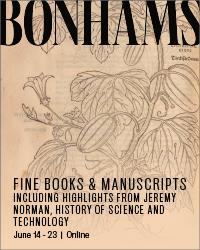


 Bonhams, June 14-23: Palm-reading, astrology, and more. Estimate: $2,000 - 3,000Bonhams, June 14-23: Benjamin Franklin. Sammelband of 45 papers on electricity. Estimate: $8,000 - 12,000Bonhams, June 14-23: The basis for the whole modern electric-power industry. Estimate: $4,000 - 6,000Bonhams, June 14-23: Edgar Allen Poe. Poe on Mesmerism. Estimate: $2,500 - 3,500Bonhams, June 14-23: Reformation - The Architect of Lutheranism on Church Unity and Dissent. Estimate: $100,000 - 150,000Bonhams, June 14-23: The Rare 3-Paper Offprint Identifying the Double Helix Structure of DNA, Signed by Crick, Wilkins, Wilson, Stokes and Gosling. Estimate: $40,000 - 60,000Bonhams, June 14-23: Autograph book and Report from the Thirtieth Indian National Congress, featuring the signatures of Mahatma Gandhi, Rabindranath Tagore, and Dadabhai Naoroji. Estimate: $6,000 - 8,000Bonhams, June 14-23: An Illustrated Miniature Hebrew Prayerbook Manuscript. Estimate: $30,000 - 50,000Bonhams, June 14-23: Autograph Working Draft of Arthur Conan Doyle's The Death Voyage. Estimate: $30,000 - 50,000Bonhams, June 14-23: "Perhaps the most celebrated and most beautiful herbal ever published." Estimate: $15,000 - 20,000Bonhams, June 14-23: Izaak Walton. The Compleat Angler or the Contemplative man's Recreation. Being a Discourse of Fish and Fishing. Estimate: $12,000 - 18,000Bonhams, June 14-23: A rare product of the Jaquard loom. Estimate: $8,000 - 12,000
 -


 Freeman’s, June 30. Thomas Jefferson’s “Birth of the New Nation” letter, carried to Paris with the Treaty of Peace, by a Jewish patriot. $100,000-200,000.Freeman’s, June 30. “The rockets’ red glare.” A British midshipman’s log recording the bombardment of Fort McHenry. $60,000-80,000.Freeman’s, June 30. The Critical Promotion of a Naval Hero, Oliver Hazard Perry Commission signed by James Madison, 1812. $40,000-60,000.Freeman’s, June 30. Born in the USA: First Day of Printing in the United States, July 4, 1776. $15,000-25,000.Freeman’s, June 30. One of the Earliest Printed Announcements of American Independence, in the Exceedingly Rare Original Wrappers, 1776. $10,000-15,000.Freeman’s, June 30. "The Two Big Guns of the N.Y. Yanks": A Striking Type 1 Press Photograph of Lou Gehrig's Hands. $8,000-12,000.Freeman’s, June 30. A Unique Contemporary Manuscript Account of Joseph Smith's Final Words to His Followers, the Day Before his Violent Death. $8,000-12,000.Freeman’s, June 30. The State of Minnesota Officially Certifies the Fourteenth Amendment to the Constitution Of the United States. $8,000-12,000.Freeman’s, June 30. Extraordinarily Large Manuscript Petition Signed by a Who's Who of Colonial New York to Queen Anne from the Colony of New York. $8,000-12,000.Freeman’s, June 30. Mickey Mantle's First Cover: The Earliest Front-Page Newspaper Image of Mickey Mantle, "Something Good from Joplin". $8,000-12,000.Freeman’s, June 30. A Call to Arms in the Months Following the Declaration of Independence: An Early Continental Army Recruitment Poster. $6,000-9,000.Freeman’s, June 30. Samuel Jones, the Statesman Behind the Newly Discovered "Jones Declaration": His Annotated Set Used in His Working Law Library. $6,000-9,000.