Aug 31 - Sep 14: Rare Maps, Charts, Atlases and more at Old World Auctions
- by Thomas C. McKinney
Highlight lots from Old World Auctions' Auction 159
Old World Auctions, the online-only auction house specializing in antique maps, globes, charts, and atlases, has a sale taking place at the time of this month’s Rare Book Monthly online publishing. Running from August 31st to September 14th, Auction 159 comprises over 800 lots spanning geographies worldwide from the 16th to the early 20th centuries. Old World says that the material from Asia, the Pacific Ocean, Caribbean Islands, Western Hemisphere, and the Mid-Atlantic and Southeastern regions of the United States is particularly strong. Several dozen lots will be listed without reserve.
The following are ten very rare highlights from the forthcoming sale:
Broadside depicting the Battle of Portobelo of 1739, "A Perspective View of ye Harbour, Castles, & Town of Porto Bello" published by Thomas and John Bowles in 1740. Est. $800-1000.
Ortelius' two-sheet maps of the British Isles and Egypt, "Britannicarum Insularum Vetus Descriptio" (Est. $3500-4500) and "Aegyptus Antiqua" (Est. $1600-2000).
Rare atlas of Maryland and DC, "New Topographical Atlas of the State of Maryland and the District of Columbia" published by Walling & Gray in 1873. Est. $1500-1800.
An important Revolutionary War map of the Battle of White Plains, "A Plan of the Operations of the King's Army Under the Command of General Sr. William Howe" by C.J. Sauthier and William Faden, published in 1777. Est. $11000-14000.
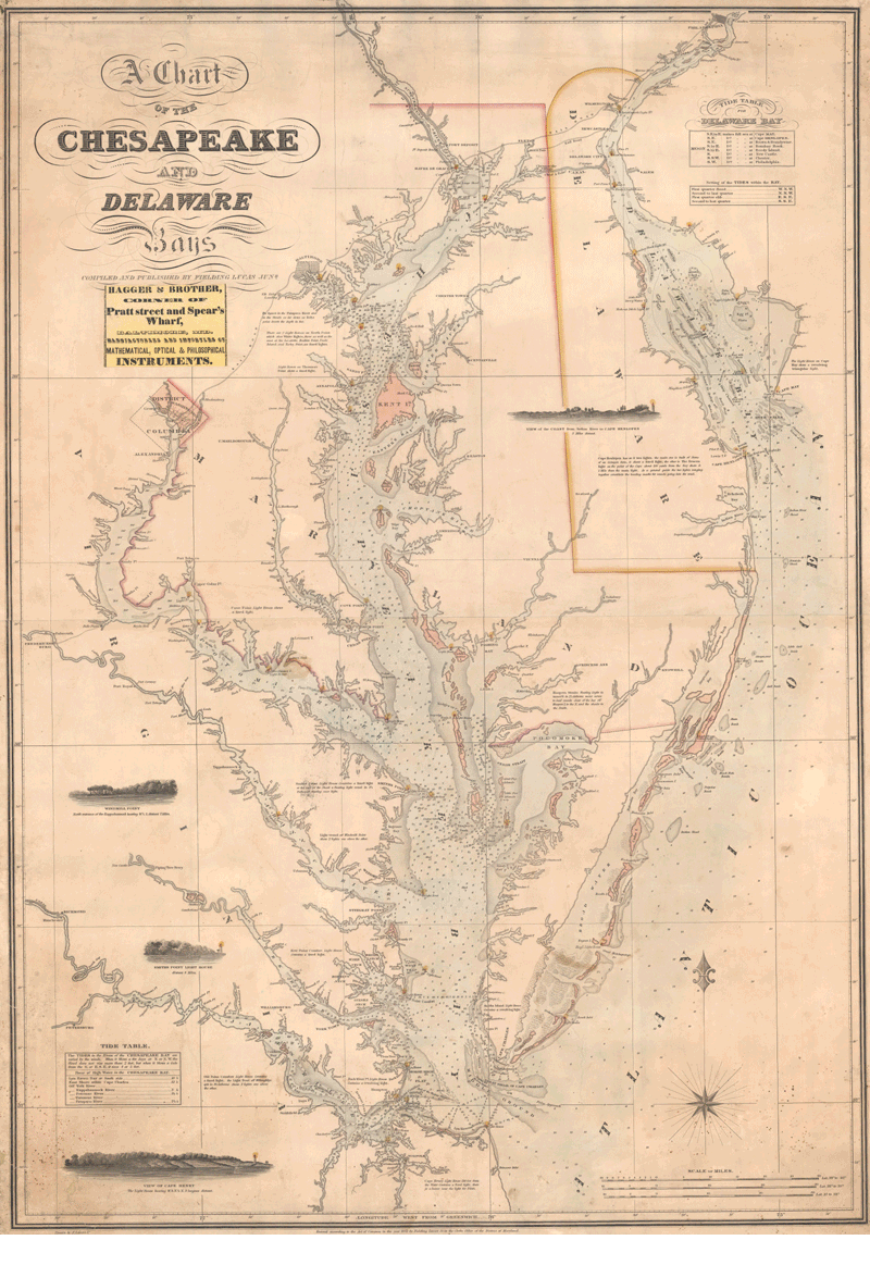
A sea chart of the Chesapeake and Delaware Bays, "A Chart of the Chesapeake and Delaware Bays" by Fielding Lucas, 1852. Est. $6000-7500.
A chart published only four months after the Battle of Cartagena, "A Plan of the Harbour Town and Castles of Carthagena..." by Philip Durell, 1741. Est. $1400-1800.
Map of the British Colonies just after the French & Indian War, "A New and Accurate Map of the British Dominions in America, According to the Treaty of 1763" by Thomas Kitchin, 1766. Est. $2200-2500.
A one-of-a-kind manuscript railroad atlas of Cincinnati, "Plats Showing the Lands of the Cincinnati & Indiana Rail Road Co. in the City of Cincinnati" published in 1869. Est. $700-850
A two-sheet map of Africa by William Berry, "Africa Divided According to the Extent of Its Principall Parts" by William Berry, 1680. Est. $2400-3000.
Waldseemuller's Ptolemaic map of Arabia, "Sexta Asie Tabula" by Waldseemuller, 1513. Est. $4000-5000.
Registration with Old World Auctions is required for first-time bidders and buyers interested in bidding, and can be done so by following this link; returning customers need only sign in with their existing login information. The sale’s online catalog is available here.
Sotheby’s, July 14: Henry De La Beche. "Awful Changes," 1830. $6,000 to $9,000.
Sotheby’s, July 15: [Apollo 11]. Flight Plan, Complete Original Printing Signed by Buzz Aldrin. $5,000 to $8,000.
Sotheby’s, July 15: Thomas Alva Edison. Documents Establishing and Ending the Edison Electric Railway Company. $20,000 to $30,000.
Sotheby’s, July 15: Richard P. Feynman. Feynman's Lectures on Gravitation 1-16, Including the Original Transcriptions of Lectures 12-16 by Morinigo and Wagner, With Richard Feynman's Manuscript Notations, 1971. $12,000 to $18,000.
Sotheby’s, July 15: [Apollo 9]. A Group of Manuals and Mission Documents used by Stuart Roosa as a member of the Astronaut Support Crew. $5,000 to $8,000.
Sotheby’s, July 15: [BYTE: The Small Systems Journal]. A collection of early foundational issues of Byte: The Small Systems Journal, with rare hardcover editions. $5,000 to $8,000.
Forum Auctions The 10th Anniversary Sale Fine Books, Manuscripts and Works on Paper July 16, 2026
Forum, July 16: Inundation papyrus. P.Michael 4, the ‘Inundation papyrus’, a geographical account of the Nile near Canopus, in Greek, remains of two columns from a manuscript scroll on papyrus, Egypt, second century CE. £12,000-18,000
Forum, July 16: Book of Hours, use of Sarum, manuscript on vellum, 6 full-page miniatures, with famous Middle English inscriptions, Southern Netherlands for the English market, [c.1430]. £30,000-50,000
Forum, July 16: Qu'ran, Arabic manuscript on burnished, stencilled, and gold-flecked paper, 447ff., Sultanate Gujarat, Ahmadabad, [after 1411 but no later than 1442]. £15,000-20,000
Forum Auctions The 10th Anniversary Sale Fine Books, Manuscripts and Works on Paper July 16, 2026
Forum, July 16: Turner (William). A New boke of the natures and properties of all wines that are commonly vsed here in England, rare first edition of the first English book on wine, By William Seres, 1568. £20,000-£30,000
Forum, July 16: Spenser (Edmund). The Faerie Queene. first edition, Printed [by John Wolfe] for William Ponsonbie, 1590. £30,000-40,000
Forum, July 16: Shakespeare (William). The Comedie of Errors, extracted from the first folio, Isaac Jaggard and Edward Blount, 1623. £15,000-20,000
Forum Auctions The 10th Anniversary Sale Fine Books, Manuscripts and Works on Paper July 16, 2026
Forum, July 16: Fleming (Ian). Casino Royale, first edition, signed presentation inscription from the author, 1953. £40,000-60,000
Forum, July 16: d'Agoty (Jacques-Fabien Gautier). Anatomie de la Tête, first edition, Paris, chez le Sieur Gautier, 1748. £10,000-15,000
Forum, July 16: Martial Arts.- Lee (Bruce). 'Praying Mantis style' Kung Fu book, containing numerous annotations, diagrams and graphs in Bruce Lee's hand, c. 1960. £50,000-70,000
Forum Auctions The 10th Anniversary Sale Fine Books, Manuscripts and Works on Paper July 16, 2026
Forum, July 16: Warre (Capt. Henry James). Sketches in North America and the Oregon Territory, first edition, rare hand-coloured issue, 1848. £30,000-40,000
Forum, July 16: Norie (John William). The Marine Atlas, or Seaman's Complete Pilot for all the principal places in the known world..., 1826. £30,000-50,000
Forum, July 16: Mao Tse-tung.- Kim Il-sung.-[Note book for visitors from China to Korea], signed by Mao and Kim, [Beijing, 1954]. £10,000-15,000


. <I>A New boke of the natures and properties of all wines that are commonly vsed here in England,</I> rare first edition of the first English book on wine, By William Seres, 1568. £20,000-£30,000")
. <I>The Faerie Queene.</I> first edition, Printed [by John Wolfe] for William Ponsonbie, 1590. £30,000-40,000")
. <I>The Comedie of Errors,</I> extracted from the first folio, Isaac Jaggard and Edward Blount, 1623. £15,000-20,000")

. <I>Casino Royale,</I> first edition, signed presentation inscription from the author, 1953. £40,000-60,000")
. <I>Anatomie de la Tête,</I> first edition, Paris, chez le Sieur Gautier, 1748. £10,000-15,000")
. 'Praying Mantis style' Kung Fu book, containing numerous annotations, diagrams and graphs in Bruce Lee's hand, c. 1960. £50,000-70,000")

. <I>Sketches in North America and the Oregon Territory,</I> first edition, rare hand-coloured issue, 1848. £30,000-40,000")
. <I>The Marine Atlas, or Seaman's Complete Pilot for all the principal places in the known world...,</I> 1826. £30,000-50,000")
